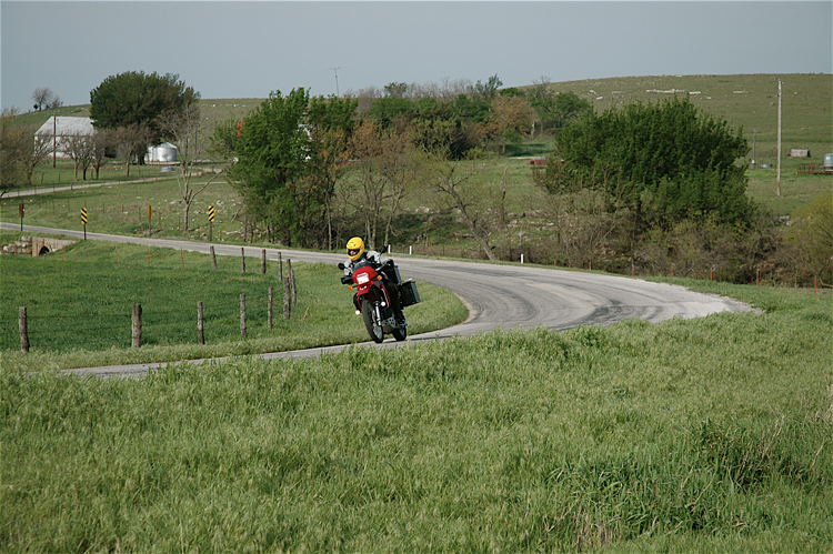
Stormin' Across Eastern Kansas

Quite a few people who haven't been to Kansas have formed their impressions of the state by watching a movie made in 1939. The Wizard of Oz, filmed in a Hollywood studio, portrays Kansas as hot, dry, tornado-ridden and tabletop flat. While this may be a somewhat apt description of western Kansas, the state's eastern region has a surprisingly hilly topography. And our five-day tour through this enchanting prairie landscape turns out to be anything but dry.
Although our designated route in eastern Kansas is all on-pavement, Jeff Armitage and I will take our dual-sport motorcycles off-road at every opportunity during the next five days. I'm expecting to get a few more dings on my 2006 Kawasaki KLR 650, but Jeff has never had his pristine 1990 Honda Transalp off-road, or even gotten it dusty as far I as I know. So I'm wondering how he'll react if his "baby" gets a few battle scars.
Monday (200 miles): Searching for Big Brutus
Bright sunshine and warm temperatures greet our departure from Arkansas City, Kansas, as we roll east on US 166. A left turn quickly has us descending into rich bottomland, snaking our way along Grouse Creek, past farms and grazing cattle. Before long, though, we're back on US 166 and looking for another interesting diversion. We find it in Sedan and stop for an early lunch at Mel's General Store. Annually, some 50,000 visitors come here to shop in the Victorian-era stores on Main Street, and to tour the surrounding countryside, which some have dubbed the "Kansas Ozarks."

The map indicates an intriguing unpaved road (CR 89) from Chautauqua to Caney that bypasses a straight section of US 166. East from Chautauqua, one unmarked gravel road after another leads us on. After we've made several uncharted turns, guided only by instinct, it becomes obvious that we're off the intended route (some would say lost). The funny thing is, though, we don't really care, because riding up, over,and around the rugged, rocky ridges of the Chautauqua Hills is just too much fun, and through some quirk of subliminal land navigation, the roads eventually lead to Coffeyville - just where we wanted to be all along!
Motorcycle & Gear
2006 Kawasaki KLR 650
Helmet: Nolan N-Com
Jacket: Olympia Bushwhacker Air Jacket
Pants: Olympia Airglide 2 Overpants
Boots: Oxtar
Gloves: Olympia Accordian
Luggage: Hepco & Becker Panniers and Dual Star Tank Bag
The Dalton Defenders Museum looks intriguing, so we stop for a tour. The Museum chronicles how four brave Coffeyville citizens lost their lives in the 1892 shootout that brought an end to the murderous Dalton Gang. Exhibits include guns, saddles, photographs taken immediately after the raid, a full-sized replica of the hearse used to carry the Daltons to their graves and other Coffeyville memorabilia. Hall of Fame baseball pitcher Walter Johnson was a resident of Coffeyville in his early days. I find this interesting because my daughters attended Walter Johnson High School in Rockville, Maryland, not far from Washington, DC, where the Washington Senators' famed pitcher became a baseball legend.

By late afternoon US 169 is leading us north toward our first day's destination, but we first have one intriguing place to stop. Approaching West Mineral, we're anxious to sight the giant that reportedly lurks in these parts. Suddenly, there he is, towering well above the surrounding tree line, which is still several miles distant. Big Brutus is 16 stories high and weighs 11 million pounds. This mighty earthmover, now retired, once ran around the clock to gouge out house-sized chunks of Kansas prairie in search of coal. Decommissioned since 1974, Big Brutus is now a well-preserved museum and tourist attraction. Adventuresome visitors can climb inside Big Brutus's cabin, with its aircraft carrier-like dimensions, and then climb to the top of the shovel.

In historic Fort Scott, we meet Ed McLiney for a delicious dinner at Rusty's Restaurant. Ed, a member of the dual-sport club Backroads Touring - Kansas, has graciously volunteered to be our off-pavement tour guide on Tuesday. While strolling through the Fort Scott National Historic Site after dinner, Ed explains that Fort Scott was among nine forts originally planned to form a line from the Great Lakes to New Orleans. They were to separate proposed Native American lands from white settlements and protect settlers.
Tuesday (180 miles): To Atchison on the Missouri River
We wake to low cloud overcast and drizzling rain on Tuesday morning. Ed leads the way on his 2007 BMW 1200 GS Adventure, followed by me, Jeff, and another club member, Eric Rickel, on his KLR, for the morning segment of today's ride. Our off-pavement course roughly follows the designated on-pavement route.
Navigating up, over, down, and around the Osage Cuestas (Spanish for 'cliff,' pronounced kwesta), we sail undaunted through the rain. The cuestas are uplifted and eroded land with exposed rocks that form hills with a steep escarpment on one side and gentler slopes on the other sides. Composed of alternating layers of sandstone, limestone, and shale, they can rise several hundred feet above surrounding farmland. After successfully negotiating several stream crossings, we're feeling very confident on the gravel roads.
