Southern Louisiana

The guys in the garage at the Transportation Revolution finish giving me directions just as a bank of inky clouds unleash their payload. Having no desire to guide the Triumph Scrambler into a curtain of precipitation, I wait patiently and try to contemplate the magnitude of the first leg of this journey.
Typical of spring storms in the Deep South, this one hits hard and moves along quickly. The retreating thunderclaps and hissing runoff begin to give way to the sounds of downtown traffic as the Triumph's twin pops to life. Within minutes the bars are pointed east on Interstate 10. Exiting onto Elysian Fields Drive, I soon find St. Claude Avenue and begin the somber ride toward the Lower Ninth Ward. In New Orleans, modern history is measured by two descriptors, pre-Katrina and post-Katrina, and here in this neighborhood it seems only the latter applies. With each passing block, those indelible TV news images begin rushing back like water pouring through the breached levees. Though the storm came roaring ashore back in August of 2005, its massive, crushing imprint still remains. Rebuilding efforts are underway in a few spots, but many streets still resemble post-apocalyptic movie sets. I had originally intended to take a series of photos, but in witnessing the true magnitude of the catastrophe that befell this once vibrant area, I keep the camera stowed. Most of the folks here lost everything and the thought of flaunting images like new baseball cards is suddenly becoming very unpalatable. This first stop is a solemn reminder of how the rug can be jerked from beneath any of us in the blink of an eye.

Back west of The Big Easy, signs for Mandeville indicate that the Lake Pontchartrain Causeway is coming up. At 24 miles in length, this masterpiece of man's handiwork is the longest over-water highway in the world. The first two-lane section opened in 1956, giving the citizens of New Orleans unprecedented access to Lake Pontchartrain's north shore. Due to increased traffic, a second span was opened in 1969. Sections of roadbed and cylindrical piles, made from pre-stressed concrete, were built lakeside and moved into place by barge, making the initial structure the world's first pre-manufactured bridge. While the ride itself isn't the most exciting in the world, the scope of civil engineering involved here is well worth seeing.
Motorcycle & Gear
2009 Triumph Scrambler
Helmet: Nolan N103 N-Com
Jacket: Triumph AS4 Tex
Pants: Triumph Alpinestars Denim Kep
Boots: Sidi Doha
Gloves: Triumph Alpinestars AS3 Carbon
Luggage: Dowco Fastrax™ Elite Tankbag, Lee Parks Design Laguna Tailpack
Having crossed the lake just ahead of the afternoon commuters, I turn west on Route 22. Though the prospect of exploring unfamiliar territory has my energy needle pegged, the map and "better" judgment conspire to end my day. I could keep chasing the sunset, but experience dictates that the map's upcoming tangle of tiny gray lines hold little promise of lodgings. A rack stack alongside I-55 in Amite seems as good a place as any to call in the dogs.
Bayou Country
With the morning sun at my back and the super slab melting into the rearview, I follow the GPS route to the northwest, toward the Mississippi state line. Before long, the flat, coastal landscape is replaced by rolling fields and deep hardwood forests. Recent rains have left the undulating pastures swathed in emerald green and with the exception of the curious, wobbly-legged calves, the groupings of cattle lazily grazing along the roadside fences are oblivious to the passing Triumph. My estimation last night that this stretch would be deserted was right on the money. A few farms and even a plantation home or two dot the countryside, but they all sit far back from the road. This loneliness, combined with plenty of smooth, winding tarmac, casts a delightful spell of nonchalance. But a nearly empty fuel tank snaps me back to reality before I blithely glide past the only pumps around for miles.

Just before reaching St. Francisville, I swing a left into the Audubon State Historic Site. This 100-acre forested park is home to Oakley Plantation, where naturalist John James Audubon briefly tutored the Pirrie family's daughter Eliza. Though a clash of personalities with Mrs. Pirrie had Audubon returning to New Orleans after only four months, he did begin or complete 32 of his remarkable avian paintings while here. Any avid bird watcher will find this side trip fascinating, and the house, on the National Register of Historic Places, is open for tours for a small fee.
After a steaming bowl of crawfish étouffé, a side of collard greens, and a fresh-from-the-oven helping of the world's best bread pudding at Eight Sisters restaurant, I lazily motor out of St. Francisville. The downhill course from town leads me to the banks of the Mighty Mississippi and the gates of the New Roads-St. Francisville Ferry. Noticing my clumsy glove-handed attempt to dig out my wallet, the attendant goes ahead and waves me aboard. "Just get it to me before we get across," he says. It's a peaceful passage too, that only costs a dollar.
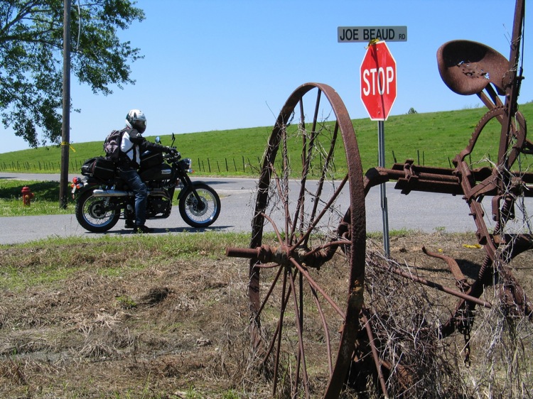
As the course leads farther south, the sights begin reflecting the big river's alluvial plain. The gentle hills have disappeared and numerous low spots are overspread with dark, glassy water and groves of cypress trees. At the northern reach of the Atchafalaya Basin, I swing left on Route 975 and ride alongside the Atchafalaya River levee through the Sherburne Wildlife Management Area. This well-maintained, hard-packed gravel road may not be everyone's cup of tea, but the Scrambler's semi-knobs and my dirt-bike background fit right in. I've been told that Cajuns like a party, and judging by the fist pumps and thumbs-up reactions I'm getting, the drivers of the few trucks I do meet seem genuinely impressed by my spirited velocity.