Southeast Oregon: Empty Land Full of Adventure

As I open my eyes and look out of my tent, the Milky Way has almost an overwhelming brightness, and I momentarily feel as if I’m being catapulted through space before I realize that I’m just lying in the middle of a remote high desert road.
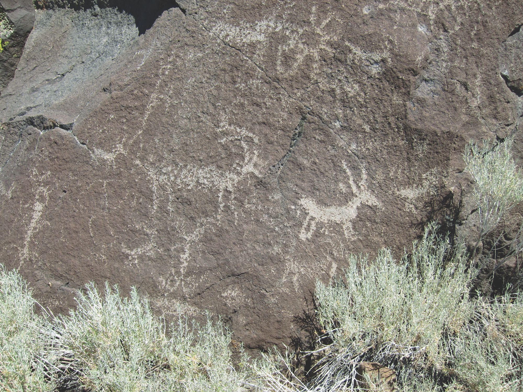
After months of research and planning, I finally leave Oregon City, OR, pointing my KTM 640 Adventure southeast in the early July sunshine to meet my friends, Ed and John (riding a 2006 BMW F 650 GS and a 2008 KLR 650), in Paisley. As this small community fades away in the rearview mirror and is replaced by dust clouds, the real journey begins as we move into the remote corner of southeast Oregon, a land with less than one human per square mile. What it lacks in population, it makes up for with its rich history including wagon roads and rock carvings called petroglyphs. For the next five days, we will get a glimpse of this vast high desert landscape and peer into a very different time and place.

Brine Shrimp and Big Sunsets
Late afternoon shadows cast an orange hue on the desert setting and illuminate the dust clouds as we travel east toward Lake Abert. After cresting a long gradual hill, this brackish lake comes into view. Brine shrimp thrive here, and the lake is an important feeding area for migratory birds along the inland portion of the Pacific Flyway.
Continuing east, we climb 2,500 feet to Abert Rim and cruise south until we find a rock-free location to camp. Given the remoteness, we simply set up camp in the middle of the road. The sunset unfolds as the clouds take the shape of an elongated wolf paw, creating an odd mystique in the warm evening air. Warm temperatures negate the need for a rain cover on the tent, allowing stunning views of the Milky Way during the night, a view missed living in the city.
Motorcycle & Gear
2002 KTM 640 Adventure
2006 BMW F 650 GS
2008 Kawasaki KLR 650
Helmet: Shoei Hornet DS
Jacket: Aerostich Darien
Pants: KLIM Dakar and Aerostich Darien
Boots: Sidi Crossfire
Gloves: KLIM Dakar
Luggage: Touratech Zega
Tent: Mountain Hardwear Skyledge 2
Past Inhabitants and a Quiet Drinking Town With a Cattle Problem
Most of today’s route is on unpaved roads, and we start early heading south. Threading our way between the rocks leads us to the top of a large canyon and to our first petroglyph site. Most of the images are distinct geometric patterns scattered on various boulders.
Steep rocky tracks make up our path for the next several miles. The high ground clearance of my KTM makes these sections easy, but Ed and John struggle with their lower clearance machines. Arriving at the high point, we descend east into Warner Valley. The humorous sign above the Hart Mountain General Store in Plush, OR, states, “A small quiet drinking town with a cattle problem.”

Before we leave the valley for Hart Mountain, we take a dirt road to another petroglyph site with different images and patterns scattered over a wide area. There are impressive illustrations of pronghorn, people, fish, and geometric shapes. One drawing depicting a series of circles has been used for target practice, a sad reminder of why these cultural treasures remain widely a secret.
We roll out of the valley climbing 3,000 feet to the Hart Mountain National Antelope Refuge headquarters. I’m anticipating the route from the refuge to the south. It’s primitive with a difficult crossing over Guano Creek. As we gaze to the south, there is just a small dirt thoroughfare and big sky! This is adventure touring at its finest—good friends, amazing scenery, and challenging roads.
