Big Bend, Texas: Into the Great Wide Open


We wake to sunny skies, a forecast in the mid-70s, and our bikes are ready to go. As I pull on my boots, my pulse quickens. I sense that this is going to be a great day for riding. Stepping outside, I find it hard to believe that it’s February. Fewer than 24 hours ago, I was waking up to snow and temperatures well below freezing. There are not many places you can travel to in North America at this time of year where perfect riding weather is practically guaranteed, but this is just such a place.
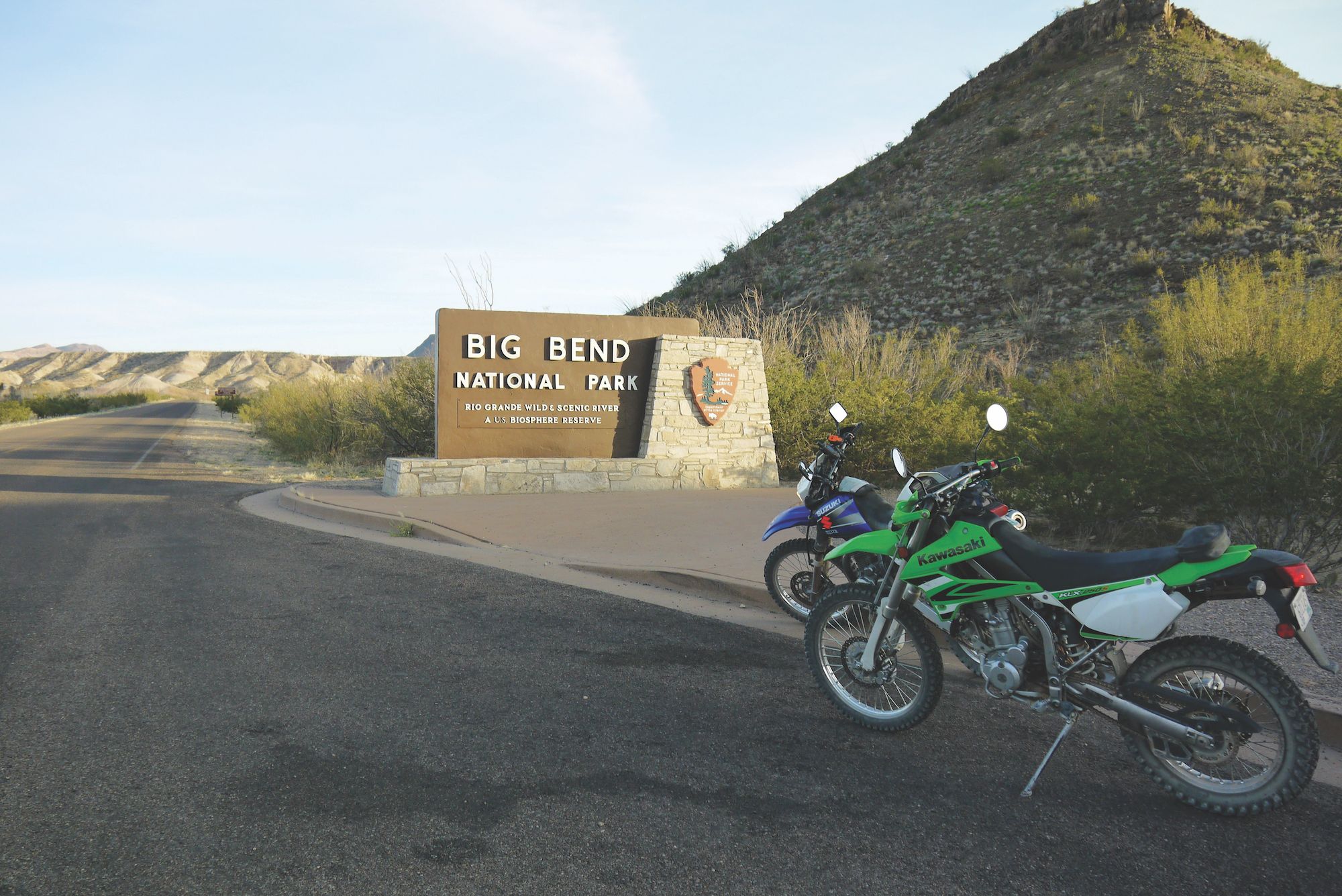
Big Bend National Park, an otherworldly place in southwestern Texas, is an area of unique contrast and beauty that was once occupied by the Chisos Indians during the time of the Aztecs. Set aside in 1933 by the state of Texas to preserve it for future generations, the park was formally adopted in 1944 by the federal government. If there is a “middle of nowhere” in the lower 48 states, this is most certainly it. That (along with the weather) is what drew us here.
On our arrival the previous evening, my wife, Kris, and I met up with Dan from GSMmotoRent to pick up our motorcycles as well as lay out our plan for three days of exploring both Big Bend National and the nearby Big Bend Ranch State Park. All our planned routes (paved and unpaved, from well-kept to primitive) are doable on larger adventure bikes, but we are more than happy taking the smaller, lighter dual sports. For the first two days, Kris selects the Kawasaki KLX 250S as her weapon of choice while I go with the Suzuki DR650. Due to limited fuel ranges on both of these rentals, route planning involves critical refueling stops to avoid long walks. On our final day’s route, we both plan to switch to the longer range Kawasaki KLR 650.
Motorcycles & Gear
Suzuki DR650
Kawasaki KLX 250S
Kawasaki KLR 650
Helmet: AFX FX39, AFX FX37
Jacket: Akito Desert, Tour Master Trinity II
Pants: Akito Desert, Tourmaster Flex
Gloves: AGV Sport Mayhem
Boots: Alpinestars Scout WP, O’Neal Element
I Think We’re Alone Now
As we set out for the national park just a few miles from our hotel, we leave behind the very small towns of Study Butte (pronounced “Stoodie Beaut”) and Terlingua. The mountains, cattle, cacti, and desert flora lend themselves to the sense of being in the Real West. We arrive at the entrance just after 9 a.m., pay the nominal entrance fee (which is good for seven days), and pick up Old Maverick Road where we get our first taste of dirt. The wide, well-groomed road takes us south toward the Rio Grande. Big Bend controls about 244 miles of the river’s 1,255-mile international boundary with Mexico and was named after a large bend in the Texas-Mexico border.

At Old Maverick’s conclusion, the Santa Elena Canyon is a 1,500-foot-deep gash in the mountains through which the Rio Grande flows. At the overlook, we take a short hike down into the gorge. After a 17-month drought, the river is low and muddy, but recent rains help to keep it flowing to the Gulf of Mexico.
We return to our bikes and head toward River Road West for what we have been told will be the most technical part of today’s route. The aptly named thoroughfare parallels (at a distance) the Rio Grande for a time before turning toward the park’s center, where it becomes River Road East. This section of the route is designated as “primitive” and calls for “four-wheel drive, high clearance vehicles.” As we begin our trek deeper into the Chisos Mountains I realize that, since entering the area, we haven’t seen another soul. Big Bend is one of the largest, most remote, and least visited national parks in the lower 48. It sees an average of 350,000 visitors a year compared to the similarly sized Yosemite, which can see upward of 4 million. That leaves a lot of room to roam, alone.

The backcountry path is rocky and somewhat narrow as it snakes up, down, and around into rugged desert. Several miles in, the serenity of the wide open space and clear blue sky begins to take hold. We pass a number of dry washes as well as spurs that provide access to the Rio Grande. It’s easy to envision ancient tribes and nomads wandering the area in search of the day’s meal. Luckily for us, we’ve packed protein bars and plenty of water.
We dismount to explore the remains of Mariscal Mine, a source of cinnabar that was refined into mercury on site from 1900 until 1943. Signs warn of the danger still present. After a 51-mile trek across the remote and beautiful Chihuahuan desert, River Road East empties onto pavement.