Lake Superior - Canadian Side
Two countries, one lake. On the US side, Lake Superior abuts small towns, local businesses, and large industrialized cities. People abound. Yet, along the Canadian border, with the exception of Thunder Bay, the land is pristine, green, and seemingly untouched by man.
As John, Jim, and I continue our Circle Tour of Lake Superior, this leg of the journey takes us from Thunder Bay to Sault Ste. Marie on the Canadian side of the border. The first and most obvious thing we notice upon entering Canada is the rural landscape, primarily consisting of farms. In the Upper Peninsula and Minnesota, there was very little agriculture, given the rocky nature of the land. Thunder Bay, however, is very much the urban scene with four-lane highways, plenty of traffic, and the familiar sights of malls, McDonald's, museums, railways - even an airport. What distinguishes Ontario's 14th-largest city is the pulp mills that produce eight-story high piles of saw dust and wood chips, soon to be your next sheet of plywood or entertainment center. There's also Fort William Historical Park, a recreation of the North West Company's inland headquarters.
A Watercolor Wash of Green and Blue

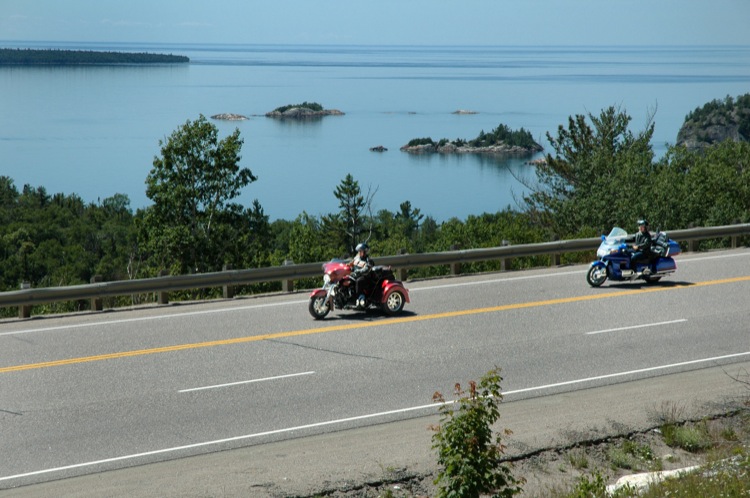
We could have easily spent three days exploring Thunder Bay, but we're here to explore all of Lake Superior's Canadian border. We point our trusty steeds northeast and head to the Ouimet Canyon, about 40 miles north of Thunder Bay, off Hwy 11/17, a well-maintained asphalt, two-lane highway, with numerous passing lanes and pull-offs for trucks. The shoulders are wide and paved. They're also busy with bicycle traffic and hikers - an odd juxtaposition to the road itself, which is occupied with heavy truck traffic, campers, and RVs. The speed limit is 90 km (60 mph), a limit that is both patrolled and enforced. Eight miles over the limit can cost you your wheels.
This section of the tour is sparsely populated as we pass through endless rolling forests of emerald green and lakes of sapphire blue. The views are breathtaking and ever-changing. In places, the forests fall away over cliffs of red granite, down to rushing streams filled with trout. The air here is addictive, sweet, fresh, and lightly tinged with pine, cedar, and the aroma of the numerous wildflowers that hug the shoulders.

It's Not What There Is, It's What There Isn't
Everywhere there are signs, big signs, flashing signs, small yellow signs, all with the same warning: "Night Danger" accompanied by a silhouette of a moose. Collisions between vehicles and moose are a huge problem here, as indicated by the heavy metal crash bars on trucks and the wrecks at the body shops. It's July and prime travel time, but it's also black-fly season and these winged insects bite. The only advantage is that they stay mostly in the forested areas, but that sends the moose out onto the roads for relief. Fortunately, our encounter with other species is limited to a few deer who hold their position off the road, fresh bear tracks on a stretch of beach, and a saber-toothed chipmunk who ran into Jim's helmet while it was on the ground.

We soon find that other signs like those indicating "Gas" aren't always convenient to see. Often I ride into a station with my low-gas light on and the odometer counting down the miles from drive to push. We also learn that with the sparseness of habitation up north there are several things you don't want to pass-up for later: gas, which is substantially more than the price of fuel in the US, food, and restrooms.
Over the River and Through the Woods
Between the towns of Pearl, ON, and Dorion, ON, we find the gravel road to Ouimet Canyon, also known as "The Grand Canyon of the North." The road is about three miles long, narrow, and winds its way through the backcountry, uphill and down. There's only one stream to cross and it's on a downhill. As we approach the bridge, there's no hint of what's to follow: it's not a hole, per say, but more like the angle of the road as it hits the flat of the bridge. We all either catch air or bottom out - or in the trike's case, both! I hit so hard, I come off the seat about six inches and upon smacking down, chip my front tooth. Not the kind of souvenir I was hoping to bring home. The Canyon is not for the faint of heart, with a suspension bridge and narrow trails to overlooks and steep cliffs, but the views are awesome. Only one-way back, over the same tooth-chipping bridge, but this time much slower.